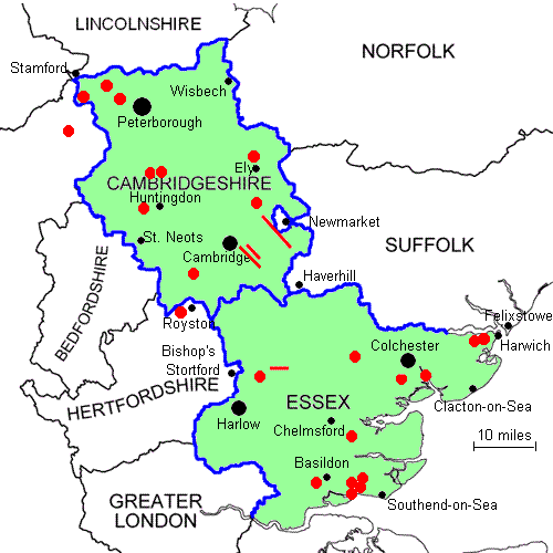
Butterfly Conservation - saving butterflies, moths and their habitats
Butterfly Conservation
40 years of saving butterflies, moths and their habitats
   Cambridgeshire and Essex Branch

GAZETEER

This is where you can find out about some of the best spots in and around Cambridgeshire and Essex for seeing butterflies.
The list is by no means exhaustive and if you can recommend any other good sites with public access,
with your suggestions and details.

Locations have been given using the National Grid Reference system, which is explained on each Ordnance Survey map.
A more detailed explanation can be found by visiting the OS website here.
When visiting a site, we recommend the use of an Ordnance Survey map; the Explorer series (1:25,000) is recommended although the Landranger series (1:50,000) will be adequate for most.

Red dot

Place mouse over the red locations for the site name and left click for details

  
Map of the Branch Area


Barnack Hills & Holes Bedford Purlieus Belfairs Wood Brampton Wood Castor Hanglands Chettisham Meadow Copperas Wood Devil's Dyke Dunmow Railway Cutting Fingringhoe Wick Fleam Dyke Friday Wood Glapthorn Cow Pastures Hadleigh Castle CP Hatfield Forest Hockley Woods Langdon Hills Markshall Wood Monks Wood Orwell Clunch Pit Pound Wood Stour Wood Therfield Heath Thrift Wood Wicken Fen Woodwalton Marsh
Where to See Individual Butterflies
NOTABLE SPECIESSITES
Chalkhill BlueDevil's DykeBarnack Hills & HolesFleam DykeTherfield Heath 
Black HairstreakBedford PurlieusBrampton WoodMonks WoodCastor HanglandsGlapthorn
Heath FritillaryThrift WoodHockley WoodBelfairs WoodPound Wood 
White AdmiralBrampton WoodFriday WoodMonks WoodStour WoodBelfairs Wood
Grizzled SkipperLangdon HillsMonks WoodWoodwalton Marsh  
Dingy SkipperDevil's Dyke    
Wall BrownDevil's Dyke (Reach end)No longer reliable anywhere but the Essex coast sea walls may offer best chance
Silver-washed Fritillary*Markshall WoodBrampton WoodBedford PurlieusHatfield Forest 
Purple HairstreakBrampton WoodCopperas WoodFingringhoe WickLangdon HillsMonks Wood
Green HairstreakDevil's DykeFriday WoodFleam Dyke  
White-letter HairstreakHadleigh Castle CPMonks WoodFriday WoodDevil's DykeHockley Wood
Marbled WhiteHadleigh Castle CPBarnack HillsChettisham MeadowTherfield Heath 
* indicates occasionally seen and not known to be established at any sites (except Markshall Wood and possibly Hatfield Forest)


When to See Individual Butterflies

Flight Times Chart

Butterflies with typical flight period covering 8th of September
Essex SkipperSmall SkipperLarge SkipperClouded YellowBrimstone
Large White (2)Small White (2)Green-veined White (2)Purple HairstreakSmall Copper (2)
Small Blue (2)Brown Argus (2)Holly Blue (2)Common Blue (2)Chalkhill Blue
White AdmiralRed AdmiralPainted Lady (2)Small Tortoiseshell (2)Peacock
Comma (2)Silver-washed FritillarySpeckled Wood (2)Wall (2)Grayling
GatekeeperMeadow BrownRinglet  
(2) indicates possible second brood
Select a Date:


Please click here for list of abbreviations

Barnack Hills & Holes
Designation: NNR (managed by NE), SAC
Habitat: Limestone grassland
Location: The reserve is situated in the village of Barnack, 11km (7 miles) north west of Peterborough.
Grid Reference: TF073048 [OS Landranger Map 142]
Key Species: Chalkhill Blue, Marbled White
UKBMS Transect: Since 1981. Visit the site page on the UKBMS website
Parking: Parking is available at several points close by, although visitors are encouraged to use the car park on Wittering Road (see Notes below for a map on NE website).
Cycle parking is also provided.
Public Transport: Buses from Stamford and Peterborough serve local villages and stop regularly in Barnack. Plan your journey here.
Cycling: To find the proximity of the reserve to either National Cycle Routes or other cycle paths, please click here to open the 'Sustrans' map of the area.
Notes: The site is open all the year round.
Download a leaflet and map by visiting the Natural England website here.

back to the mapBack to the Map       back to the mapBack to the table 'Where to See Individual Species'

Bedford Purlieus
Designation: NNR (managed by Forestry Commission)
Habitat: Ancient woodland (mainly oak and ash)
Location: Approximately 12km (7 miles) west of Peterborough and 2km (1 mile) west of the town of Wansford. The reserve is south of the A47, the road forming part of its northern boundary. The woods are accessed via a track going south off the A47.
Grid Reference: TL040996 [OS Landranger Map 141]
Key Species: Black Hairstreak, Silver-washed Fritillary
Parking: Limited car parking facilities are available on the farm track between the A47 and the Wansford to Kings Cliffe Road.
Public Transport: The nearest train station is Peterborough with regular bus services from Peterborough to Wansford. A seasonal steam locomotive service is provided by the Nene Valley Railway between Peterborough and Wansford. Plan your journey here.
Cycling: To find the proximity of the reserve to either National Cycle Routes or other cycle paths, please click here to open the 'Sustrans' map of the area.
Notes: The site is open all the year round.
Visit the Natural England website for further information.

back to the mapBack to the Map       back to the mapBack to the table 'Where to See Individual Species'

Belfairs Wood
Designation: SSSI (part), LNR (part) managed by Southend-on-Sea Borough Council
Habitat: Ancient semi-natural woodland (mainly oak, birch and hornbeam)
Location: In the north west suburbs of Southend-on-Sea, between Hadleigh and Eastwood.
Grid Reference: TQ833877 [OS Landranger Map 178]
Key Species: Heath Fritillary (re-established 1997) & White Admiral
Parking: There is a car park (fee payable) at TQ833877
Public Transport: The nearest train station is Leigh-on-Sea (services run by the train operator c2c). Plan your journey here.
Cycling: To find the proximity of the reserve to either National Cycle Routes or other cycle paths, please click here to open the 'Sustrans' map of the area.
Notes: The site is open all the year round.
Whilst the whole area is considered to be part of the Hadleigh Great Wood complex, the eastern half of the woodland is referred to as Belfairs Wood, which is found within the boundaries of Belfairs Park. The western area is called Hadleigh Great Wood, which together with Dodds Grove at the north west corner, forms the Belfairs Nature Reserve, and is managed by Southend-on-Sea Borough Council.
Visit the Natural England website to view a map of the designated SSSI area.
Pound Wood and Starvelarks Wood are adjacent and also sites for Heath Fritillary.

back to the mapBack to the Map       back to the mapBack to the table 'Where to See Individual Species'

Brampton Wood
Designation: SSSI, BCNP Wildlife Trust Reserve
Habitat: Ancient woodland (mainly oak, ash and field maple)
Location: The reserve is located near the village of Brampton, 6km (4 miles) W of Huntingdon
Grid Reference: TL184698 [OS Landranger Map 153]
Key Species: Black Hairstreak, Silver-washed Fritillary, White Admiral, Purple & White-letter Hairstreak
Parking: From the A1, take the A14 exit towards Huntingdon then the first exit off the A14 to Brampton along the B1514. Go straight ahead at first roundabout then right at the second roundabout. Turn right at T-junction onto the road to Grafham.
Follow the road through the village and over the A1 and the reserve is on the N side of the road 1.5 miles out of Brampton. A brown sign indicates the entrance to a small car park.
Public Transport: The nearest train station is Huntingdon, which has bus services to Brampton and Grafham. Plan your journey here.
Cycling: To find the proximity of the reserve to either National Cycle Routes or other cycle paths, please click here to open the 'Sustrans' map of the area.
Notes: The site is open all the year round.
Visit the BCNP Wildlife Trust website for further information.

back to the mapBack to the Map       back to the mapBack to the table 'Where to See Individual Species'

Castor Hanglands
Designation: NNR (managed by NE)
Habitat: Four distinct habitats - woodland, grassland, scrub and wetland
Location: 3km (2 miles) north of the villages of Ailsworth and Castor and 7km (4 miles) to the west of Peterborough.
Grid Reference: TF122023 [OS Landranger Map 142]
Key Species: Black Hairstreak
UKBMS Transect: Since 1975. Visit the site page on the UKBMS website
Parking: There is car parking close to the reserve on Heath Road, connecting Ailsworth and Helpston at TF122023. There is some disabled access with a private road allowing limited access to the drier parts of the reserve. Contact the Site Manager for details by telephoning 01780 752796.
Public Transport: The nearest train station is Peterborough and there are bus services (sometimes restricted) from Peterborough to local villages. Castor village is close to the route of the 'Green Wheel', a 70 km network of cycle paths centred on Peterborough. Plan your journey here.
Cycling: To find the proximity of the reserve to either National Cycle Routes or other cycle paths, please click here to open the 'Sustrans' map of the area.
Notes: The site is open all the year round.
Visit the Natural England website where you can download a leaflet and map.

back to the mapBack to the Map       back to the mapBack to the table 'Where to See Individual Species'

Chettisham Meadow
Designation: BCNP Wildlife Trust Reserve
Habitat: Hay meadow & Neutral grassland
Location: The reserve is located next to Chettisham village, 2 miles north of Ely
Grid Reference: TL540830 [OS Landranger Map 143]
Key Species: Marbled White, Brown Argus & Small Copper. Orchids include Green-winged, Common spotted and Bee.
Parking: From the centre of Ely, take Lynn Road north towards Chettisham. In the village, turn left to St. Michael's Church and park in the limited on-road space available. Walk left past the church, follow by-way across the busy A10. After 400 metres, take a left track at junction and Chettisham Meadow is 200m on the left.
Public Transport: The nearest train station is Ely, which has bus services to Chettisham (leaving a 0.5 mile walk) and Little Downham (leaving a 1.5mile walk). Plan your journey here.
Cycling: To find the proximity of the reserve to either National Cycle Routes or other cycle paths, please click here to open the 'Sustrans' map of the area.
Notes: The site is open all the year round. Grazing animals are present at certain times of the year.
Visit the BCNP Wildlife Trust website for further information.

back to the mapBack to the Map       back to the mapBack to the table 'Where to See Individual Species'

Copperas Wood
Designation: SSSI, Essex Wildlife Trust Reserve
Habitat: Ancient woodland (mainly coppiced Sweet Chestnut and Hornbeam)
Location: The reserve is 2km (1 mile) from the village of Ramsey on the B1352 from Ramsey to Manningtree. The entrance is 300m down a public footpath (the Essex Way) beside a large white flat-roofed house.
Grid Reference: TM199312 [OS Landranger Map 169]
Key Species: Purple Hairstreak
Parking: There is limited parking (i.e. one or two cars) at the entrance, or on the roadside.
Public Transport: The nearest train station is Wrabness which is 0.5miles from the reserve entrance. Regular buses running between Harwich and Colchester go past the reserve on the B1352. Plan your journey here.
Cycling: To find the proximity of the reserve to either National Cycle Routes or other cycle paths, please click here to open the 'Sustrans' map of the area.
Notes: The site is open all the year round.
Visit the Essex Wildlife Trust website for further information.
The RSPB reserve at Stour Wood lies about 1 mile to the W and is well worth visiting (White Admiral)

back to the mapBack to the Map       back to the mapBack to the table 'Where to See Individual Species'

Devil's Dyke
Designation: Scheduled Ancient Monument, SSSI and SAC
Habitat: Chalk grassland
Location: The Dyke stretches in a near perfect straight line for 12km (7 miles) from the Fen edge at Reach, across the open chalk landscape near Newmarket and towards the more wooded landscape on the clay ridges, ending at Ditton Green.
Grid Reference: TL615617 [OS Landranger Map 154]
Key Species: Chalkhill Blue, Dingy Skipper, Green Hairstreak, White-letter Hairstreak, Brown Argus, Wall Brown (at Reach end)
UKBMS Transect: Since 2003. Visit the site page on the UKBMS website
Parking: There is a small car park at Reach, near Swaffham Prior on the B1102 and one at the Newmarket July Racecourse
Public Transport: The nearest train stations are at Newmarket and Dullingham, both about 2 miles from the Dyke. There are regular buses to Reach, Swaffham Prior, Newmarket July racecourse and Woodditton. Plan your journey here.
Cycling: To find the proximity of the reserve to either National Cycle Routes or other cycle paths, please click here to open the 'Sustrans' map of the area.
Notes: The site is open all the year round.
This is one of the area’s finest butterfly sites and is where the Branch has carried out extensive conservation work over the past few years.
Although the DD restoration project officially ended in 2006, take a look at its website for background information.
Warning: Devil's Dyke is very popular with dog walkers and not all are responsible about cleaning up afterwards.

back to the mapBack to the Map       back to the mapBack to the table 'Where to See Individual Species'

Dunmow Railway Cutting
Designation: Forms part of the Flitch Way Country Park
Habitat: Sloping grassland formed by railway cutting on the (now disused) Bishop’s Stortford to Braintree branch line.
Location: 2km (1 mile) west of Great Dunmow.
Grid Reference: TL614215 [OS Landranger Map 167]
Key Species: The cutting hosts a general array of the more common species including Common Blue, Ringlet, Gatekeeper, Essex and Small Skipper.
Parking: There is room for several cars in a layby (Grid ref: TL609217) on the S side of the B1256, just over 1 mile W of Great Dunmow. From here, walk W 100 yards along the B1256, turn left (south) down Buttley’s Lane for about 200 yards and then left (east) onto the old railway line. The cutting is about 500 yards along the track.
Public Transport: The nearest train station is Braintree from where there is a bus service to Great Dunmow and Takeley. Alternatively, there is a bus service from the railway station at Bishop’s Stortford to Great Dunmow. Plan your journey here.
Cycling: To find the proximity of the reserve to either National Cycle Routes or other cycle paths, please click here to open the 'Sustrans' map of the area.
Notes: The site is open all the year round.
Visit the Essex County Council website for further information.
Download a very useful leaflet here.

back to the mapBack to the Map       back to the mapBack to the table 'Where to See Individual Species'

Fingringhoe Wick
Designation: Essex Wildlife Trust Reserve, SSSI & SPA (part)
Habitat: The reserve has an immense range of habitats, including patches of grassland and gorse heathland, and a mixed plantation of trees, including conifers. The river frontage provides additional habitats such as reedbeds, saltmarsh, foreshore and inter-tidal mudflats.
Location: The reserve lies 5km (3 miles) south-east of Colchester, signposted from there with brown Nature Reserve signs. Take the B1025 from Colchester towards Mersea for 5km (3 miles). After crossing the Roman River turn first left and follow the signs to the reserve. The lanes between Fingringhoe village and the reserve are narrow – please drive with caution. A 10 mph limit is in force on the reserve itself. A metalled road leads to the Centre car park.
Grid Reference: TM041195 [OS Landranger Map 168]
Key Species: Green Hairstreak, Small Copper
Parking: Ample parking at the Visitor Centre.
Public Transport: Not suitable for access via public transport
Cycling: To find the proximity of the reserve to either National Cycle Routes or other cycle paths, please click here to open the 'Sustrans' map of the area.
Notes: The Visitor Centre and Nature Reserve is open daily from 9 am – 5 pm, except Mondays, Christmas Day and Boxing Day.
All visitors to the nature reserve are required to enter the Fingringhoe Centre first, to obtain a day permit.
The Trust invites donations from non-members of £1 or more for adults and 50p for children. Visit the Essex Wildlife Trust website for further information.

back to the mapBack to the Map       back to the mapBack to the table 'Where to See Individual Species'

Fleam Dyke
Designation: Scheduled Ancient Monument & SSSI
Habitat: Chalk grassland
Location: About 6km (4 miles) SE of Cambridge, the ditch and rampart, 26m wide and up to 3.5m high, stretches for 5km (3 miles) from Fulbourn SE across the chalk to Balsham.
Key Species: A small but expanding colony of Chalkhill Blue and some of the more common species such as Brimstone, Small & Essex Skipper, Green Hairstreak, Painted Lady, Meadow Brown and Common Blue.
Parking: The Fleam Dyke footpath can be started at either the northern end near Fulbourn (TL536557 [OS Landranger Map 154]) or Balsham (TL579513 [OS Landranger Map 154]) with limited parking at both points.
The Dyke crosses the A11 at the half way point where there is also limited parking at a lay-by on the southbound carriageway (TL549543).
Public Transport: The nearest train station is Cambridge, about 6km from the Fulbourn end of the Dyke. There is a regular Stagecoach bus service from Cambridge Drummer Street bus station to Fulbourn (No 1, 16 & 17) and also to Balsham (No 16).
Check for up-to-date details on the Cambridge travel line Tel: 0870 608260 or their website. Alternatively, Plan your journey here.
Cycling: To find the proximity of the reserve to either National Cycle Routes or other cycle paths, please click here to open the 'Sustrans' map of the area.
Notes: The site is open all the year round. Cycling is NOT permitted on the footpath.
Visit the Cambridge Green Belt Project website for more information.
The Dyke is supported by a conservation society 'The Friends of the Roman Road and Fleam Dyke'.
For more information, contact:
The Cambridge Green Belt Project
The Manor House
Great Cambourne
Cambridge CB3 6DH Tel: 01954 713530

back to the mapBack to the Map       back to the mapBack to the table 'Where to See Individual Species'

Friday Wood
Designation: SSSI (owned by Ministry of Defence)
Habitat: Ancient woodland
Location: The wood lies 5km (3 miles) SW of Colchester on the E side of a minor road that runs S from Berechurch Hall Road to the village of Layer de la Haye, parallel to the B1026 (Colchester to Maldon) road
Grid Reference: TL986209
Key Species: White Admiral, Purple Hairstreak, White-letter Hairstreak
Parking: There is a small car park located just off the road at TL986209 [OS Landranger Map 168]
Public Transport: The nearest train station is Colchester.
Bus services from Colchester to Layer and Maldon pass along the Berechurch Hall Road, leaving a walk of about 1km to the reserve entrance. Plan your journey here.
Cycling: To find the proximity of the reserve to either National Cycle Routes or other cycle paths, please click here to open the 'Sustrans' map of the area.
Notes: The site is open all the year round

back to the mapBack to the Map       back to the mapBack to the table 'Where to See Individual Species'

Glapthorn Cow Pastures
Designation: SSSI & an BCNP Wildlife Trust reserve
Habitat: Woodland comprised of dense blackthorn scrub and ash-maple
Location: 19km (12 miles) SW of Peterborough. From Oundle, head north west to Glapthorn, and then head west to the Benefields. After 2km (1 mile), the reserve is on the right (north side of the road).
Grid Reference: TL006903 [OS Landranger Map 141]
Key Species: Black Hairstreak
Parking: There is limited parking on the broad verge, opposite the reserve entrance at TL006903
Public Transport: The nearest railway station is Peterborough from where there is a twice daily bus service to Glapthorn village (via Oundle), leaving a walk of about 1 mile. Plan your journey here.
Cycling: To find the proximity of the reserve to either National Cycle Routes or other cycle paths, please click here to open the 'Sustrans' map of the area.
Notes: The site is open all the year round. Visit the the BCNP Wildlife Trust website for further information.

back to the mapBack to the Map       back to the mapBack to the table 'Where to See Individual Species'

Hadleigh Castle Country Park
Designation: SSSI (part) & SPA, (owned and managed by Essex County Council)
Habitat: A mosaic of grassland, scrub and light woodland on a hillside which runs down (steeply in places) to grazing marsh, seawall and saltmarsh
Location: This fine country park lies alongside the River Thames between South Benfleet and Leigh-on-Sea
Grid Reference: TQ799870 [OS Landranger Map 178]
Key Species: White-letter Hairstreak, Essex Skipper, Marbled White and occasional Clouded Yellow
Parking: The main access point is from a car park at the end of Chapel Lane, which leaves the A13 opposite the Waggon and Horses public house in Hadleigh. Other access points lie at the end of School Lane, 250 yards NE of Benfleet station (at TQ778860) and from a footpath just W of Leigh-on-Sea train station
Public Transport: The nearest train station is Benfleet (on the Fenchurch Street to Southend line), which is a few minutes walk from the W end of the CP. Bus services run along the A13 through Hadleigh (get off at the Waggon and Horses PH) and to Benfleet train station. Plan your journey here.
Cycling: To find the proximity of the reserve to either National Cycle Routes or other cycle paths, please click here to open the 'Sustrans' map of the area.
Notes: The area is open all year round and the best WLH areas are at the west end of the CP at TQ788859 and TQ885857.
Visit the Essex CC website for further information.

back to the mapBack to the Map       back to the mapBack to the table 'Where to See Individual Species'

Hatfield Forest
Designation: National Trust Nature Reserve, SSSI & NNR
Habitat: Ancient Woodland
Location: 5km (3 miles) east of Bishop's Stortford
Grid Reference: TL537199 [OS Landranger Map 167]
Key Species: Silver-washed Fritillary
Parking: The Bush End car park (fee payable) (located at TL547202) is always open while the car park at Shell House is generally open at weekends and during school holidays. There is also space for 2 - 3 cars at the roadside near the sharp bend just east of Woodside Green. There is open foot access to much of the forest.
Public Transport: The nearest railway station is Bishop's Stortford, about a 15 minute taxi ride away. There is an hourly bus service (First Village Link No 7). Click here to download a public transport leaflet. Alternatively, Plan your journey here.
Cycling: To find the proximity of the reserve to either National Cycle Routes or other cycle paths, please click here to open the 'Sustrans' map of the area.
Notes: Silver-washed Fritillaries have been recorded in the forest in 2006 and 2007. Beggars Hall coppice (the western area of the forest) and the area around Shell House are probably the best places to see them during July.
Visit the National Trust website for further information.

back to the mapBack to the Map       back to the mapBack to the table 'Where to See Individual Species'

Hockley Woods
Designation: LNR, SSSI (owned by Rochford DC and managed in collaboration with Natural England)
Habitat: Ancient woodland of mainly hornbeam, willow, sweet chestnut and oak (with coppicing of hornbeam and sweet chestnut in selected areas).
Location: The woods lie just south of the village of Hockley, near Basildon.
Grid Reference: TQ834924 [OS Landranger Map 178]
Key Species: Heath Fritillary (re-established 1987), White-letter Hairstreak
Parking: Leave the M25 at junction 29 and take the A127 towards Southend-on-Sea, and then the A129 to Rayleigh. At Rayleigh take the B1013 to Hockley. The car park is next to the Bull Inn public house.
Public Transport: The nearest train station is Hockley, about 20 minutes walk from the reserve. Bus services from Rayleigh and Southend run past the main entrance. Plan your journey here.
Cycling: To find the proximity of the reserve to either National Cycle Routes or other cycle paths, please click here to open the 'Sustrans' map of the area.
Notes: The site is open all year round.

back to the mapBack to the Map       back to the mapBack to the table 'Where to See Individual Species'

Langdon
Designation: Essex Wildlife Trust Reserve
Habitat: A mosaic of habitats which include flower-rich meadows, ponds, together with ancient and secondary woodland.
Location: 6km (4 miles) West of Basildon.
Grid Reference: TQ659874 [OS Landranger Map 178]
Key Species: Grizzled Skipper, Purple Hairstreak
UKBMS Transect: Since 1999. Visit the site page on the UKBMS website
Parking: Leave the M25 at junction 29 and take the A127 to Basildon. After about 4 miles, turn off onto the B148, following the brown-and-white duck signs until you reach the car park at the Langdon visitor centre on the LHS of the road.
Public Transport: The nearest train station is Langdon (on the Fenchurch Street to Southend line) which is less than 800m from the reserve. Regular bus services run from Basildon town centre to Langdon train station and to Langdon Hills. Plan your journey here.
Cycling: To find the proximity of the reserve to either National Cycle Routes or other cycle paths, please click here to open the 'Sustrans' map of the area.
Notes: The site is open all the year round which, together with the Langdon Hills Country Park (managed by Thurrock Council) to the South and East, forms one of the largest areas of nature conservation in Essex. Visit the EWT website for the opening times of the visitor centre.

back to the mapBack to the Map       back to the mapBack to the table 'Where to See Individual Species'

Markshall Wood
Designation: Privately owned Woodland
Habitat: Woodland (and Deer Park)
Location: 8km (5 miles) east of Braintree
Grid Reference: TL840254 [OS Landranger Map 168]
Key Species: Silver-washed Fritillary
Parking: The car park at the Visitor Centre is free but admission to the Gardens, Arboretum and Woodland Walks costs £3. However, access to much of the wood can be made along several rights of way (public footpaths).
Public Transport: The nearest railway stations are Marks Tey and Kelvedon, both about a 15 to 20 minute taxi away. There is no suitable bus service. Plan your journey here.
Cycling: To find the proximity of the reserve to either National Cycle Routes or other cycle paths, please click here to open the 'Sustrans' map of the area.
Notes: Once naturally occuring here, the Silver-washed Fritillary was lost when the woods were planted with conifers in the 1950s. However a re-introduction scheme involving the Colchester Natural History Society, Natural England and the Forestry Commission is helping introduce the species back to the Thrift Wood area of the Markshall estate.
Visit the Markshall Wood website for further information and a map of the site.
Click here to see the BBC Essex story (and related 5 minute sound clip).
The best places to see the SWFs are along the path to the east of the deer fenced area (not a public right of way), along the avenue of Oak trees (public footpath), and in Thrift Wood (the area SE of the public footpath).

back to the mapBack to the Map       back to the mapBack to the table 'Where to See Individual Species'

Monks Wood
Designation: NNR
Habitat: Ancient woodland consisting mainly of ash, oak and hazel with some coppicing on a 15 or 20 year cycle. The site is also notable for its population of rare wild service trees.
Location: 10 km north of Huntingdon and 1 km to the east of the A1 (M) between junctions 14 and 15, near the A1/A14 junction. The reserve is accessed via the B1090 (from the B1043). The nearest village is Woodwalton.
Grid Reference: TL199792 [OS Landranger Map 142]
Key Species: Black Hairstreak, Grizzled Skipper, White-letter Hairstreak, Purple Hairstreak and White Admiral
UKBMS Transect: Since 1973. Visit the site page on the UKBMS website
Parking: There is limited car parking at a lay-by on the B1090, near the entrance to the reserve at TL199792.
Public Transport: The nearest railway station is Huntingdon (6 miles/10 km south) or Peterborough (15 miles/25 km north). The frequent train service from London Kings Cross to Huntingdon takes about 1 hour. Taxis are available at Huntingdon station. And there are bus services (sometimes infrequent) to Woodwalton (check out the Cambridgeshire CC transport website for further information). Alternatively, Plan your journey here.
Cycling: To find the proximity of the reserve to either National Cycle Routes or other cycle paths, please click here to open the 'Sustrans' map of the area.
Notes: The site is open all the year round, apart from occasional closures for shooting – please check in advance if travelling any distance and obey any warning notices.
Visit the Natural England website for further information and a leaflet.

back to the mapBack to the Map       back to the mapBack to the table 'Where to See Individual Species'

Orwell Clunch Pit
Designation: SSSI (part)
Habitat: Chalk grassland
Location: On the north side of the village of Orwell, a small village 11km (7 miles) north of Royston & 11km (7 miles) south west of Cambridge
Grid Reference: TL364504 [OS Landranger Map 154]
Key Species: Small Copper, Common Blue, Brown Argus and the rare Chalk Carpet moth
Parking: There is a car park on the High Street in Orwell village at TL364504.
Public Transport: The nearest railway station is Shepreth (2 miles/3 km south east). A frequent train service from London Kings Cross takes under an hour. There is an infrequent daily bus service to Orwell from Cambridge (Whippet Coaches No.75). Plan your journey here.
Cycling: To find the proximity of the reserve to either National Cycle Routes or other cycle paths, please click here to open the 'Sustrans' map of the area.
Notes: The site is open all the year round
Wheelchair access: From the car park on the high street exit via the top left corner, follow the path up the hill to the wheelchair accessible kissing gate (if you need the gate unlocked it works on the RADAR key system)
Visit the Natural England website and the village website for further information.

back to the mapBack to the Map       back to the mapBack to the table 'Where to See Individual Species'

Pound Wood
Designation: Essex Wildlife Trust Reserve
Habitat: Ancient woodland with some very old secondary woodland in the south west area
Location: In the north west suburbs of Southend-on-Sea, between Hadleigh and Eastwood.
Grid Reference: TQ816888 [OS Landranger Map 178]
Key Species: Heath Fritillary (re-established in 1998)
Parking: Turn south off the A127 at Rayleigh Weir on to Rayleigh Road (A129) and turn left on to Daws Heath Road at the Woodmans PH mini-roundabout. Alternatively, join the A129 from the A13, and turn right on to Daws Heath Road. Park on local streets with consideration for residents.
Public Transport: The nearest railway station is Leigh-on-Sea, about 2.5km from the reserve. A regular bus services (except Sundays) runs along Rayleigh Road from Rayleigh, Leigh, Chalkwell and Westcliff railway stations, and Southend bus station; get off at Rivers Corner.
For Evenings and Sundays use the service serving Rayleigh station and Southend bus station via the A13 and get off at Woodman’s Arms. Plan your journey here.
Cycling: To find the proximity of the reserve to either National Cycle Routes or other cycle paths, please click here to open the 'Sustrans' map of the area.
Notes: The site is open all year round. Visit the Essex Wildlife Trust website for further information.
Belfairs Wood to the south east and Starvelarks Wood to the west are close-by and are also sites for Heath Fritillary.

back to the mapBack to the Map       back to the mapBack to the table 'Where to See Individual Species'

Stour Wood
Designation: SSSI (owned by Woodland Trust and leased to RSPB)
Habitat: Ancient semi-natural woodland and one of the best sweet chestnut woods in Essex.
Location: 6km (4 miles) west of Harwich, between the villages of Wrabness and Ramsey. Turn off the A120 Colchester to Harwich road on to the B1352.
Grid Reference: TM191310 [OS Landranger Map 169]
Key Species: White Admiral
UKBMS Transect: Since 1983. Visit the site page on the UKBMS website
Parking: There is a car park at the main entrance, which is signposted from the B1352, at TM191310
Public Transport: The nearest railway station is Wrabness, about 0.8km from the reserve entrance (along a public footpath). Regular buses running between Harwich and Colchester go past the reserve on the B1352. Plan your journey here.
Cycling: To find the proximity of the reserve to either National Cycle Routes or other cycle paths, please click here to open the 'Sustrans' map of the area..
Notes: The site is open all year round. Visit the Woodland Trust website for further information.
The Essex Wildlife Trust reserve at Copperas Wood lies about 1 mile to the east and is well worth visiting (Purple Hairstreak).

back to the mapBack to the Map       back to the mapBack to the table 'Where to See Individual Species'

Therfield Heath
Designation: SSSI & LNR (owned and managed by the Therfield Conservators) – the beech woodland Fox Covert forms part of the overall Heath and is a Herts & Middlesex Reserve
Habitat: Chalk grassland
Location: 2km (1 mile) south west of Royston
Grid Reference: TL336403 [OS Landranger Map 154]
Key Species: Chalkhill Blue, Marbled White & Brown Argus
Parking: There is a car park at the reserve entrance on the south side of Baldock Road at TL336403
Public Transport: The nearest railway station is Royston, a 10 minute walk from the reserve. Plan your journey here.
Cycling: To find the proximity of the reserve to either National Cycle Routes or other cycle paths, please click here to open the 'Sustrans' map of the area.
Notes: The site is open all year round. Visit the Herts & Middlesex WT website for further information.

back to the mapBack to the Map       back to the mapBack to the table 'Where to See Individual Species'

Thrift Wood
Designation: Essex Wildlife Trust Reserve
Habitat: Ancient woodland consisting of hornbeam coppice with many oak standards, some birch, ash and coppiced sweet chestnut. There are also a number of wild service trees.
Location: 11km (7 miles) south east of Chelmsford
Grid Reference: TL790017 [OS Landranger Map 167 & 168]
Key Species: Heath Fritillary (re-established in 1984)
Parking: The entrance is on the B1418 road south of the Brewers Arm pub in Bicknacre. There is parking for a one or two cars at the main gate, with overflow parking on the opposite verge.
Public Transport: The nearest railway station is Chelmsford. There is a regular bus service from Chelmsford to South Woodham Ferrers, stopping at the main gate to the wood. Plan your journey here.
Cycling: To find the proximity of the reserve to either National Cycle Routes or other cycle paths, please click here to open the 'Sustrans' map of the area.
Notes: The site is open all year round. Visit the EWT website for further information.

back to the mapBack to the Map       back to the mapBack to the table 'Where to See Individual Species'

Wicken Fen
Designation: National Trust Nature Reserve, NNR
Habitat: Wicken Fen is divided by a man-made watercourse called Wicken Lode. The area north of Wicken Lode, together with a small area known as Wicken Poors' Fen, forms the NNR. These areas contain original peat fen with communities of carr and sedge. They support rare and uncommon fenland plants such as marsh pea, Cambridge milk parsley, fen violet and marsh fern. This part of the Fen can be enjoyed from a series of boardwalks. The area south of the Lode is called Adventurer's Fen and consists of rough pasture, reedbed and pools. The dykes, abandoned claypits and other watercourses carry a great wealth of aquatic plants, many of which are uncommon elsewhere.
Location: 16km (10 miles) north east of Cambridge, situated in between the villages of Wicken and Upware on the A1123.
Grid Reference: TL555705 [OS Landranger Map 154]
Key Species: The Fen hosts a general array of the more common species including Green Hairstreak and Brown Argus. The nationally rare Reed Leopard moth is common at the site. Other local moths include Cream-bordered Green Pea, Yellow-legged Clearwing and Emperor. The reserve also supports large numbers of snail, spider and beetle species. Damselflies found here include the Emerald, Azure and Common Blue; together with dragonflies such as the Southern and Brown hawker, Emperor, Hairy, and Black-tailed Skimmer.
UKBMS Transect: Since 1979. Visit the site page on the UKBMS website
Parking: There is ample parking within a short walk from the Visitor Centre for cars and coaches. For disabled visitors, closer parking is available by arrangement with the Visitor Centre staff.
Cycling: National Cycle Network Route 11 from Ely to Burwell brings you through the reserve. If biking by train, cycle from Waterbeach or Ely stations. Cycle racks are available at the Fen. Click here to open the 'Sustrans' map of the area.
Public Transport: The nearest railway station is Ely. There are regular bus services from Cambridge to Ely which stop at Soham which is about 5km away.
Visit the National Trust website for further information on getting there. Alternatively, Plan your journey here.
Notes: The site is open all the year round (except Christmas Day) and has a visitor centre and café. Admission fee applies to non NT members.
Visit the National Trust's Wicken Fen website and the Natural England website for further imnformation.

back to the mapBack to the Map       back to the mapBack to the table 'Where to See Individual Species'

Woodwalton Marsh
Designation: SSSI & BCNP Wildlife Trust reserve
Habitat: Unimproved grassland
Location: This small site (only 2 acres) is 10km (6 miles) NW of Huntingdon. From the B1090 Abbotts Ripton to Alconbury road turn right and right again into Wood Walton. Pass beneath the railway line and take the first left onto New Road.
Grid Reference: TL212813 [OS Landranger Map 142]
Key Species: Grizzled Skipper along with Marbled White. Flora includes Pyramidal orchid and the nationally scarce Sulphur Clover.
Parking: Park in the passing place opposite the gate to the reserve at TL212813
Public Transport: The nearest railway station is Huntingdon from where there is a infrequent bus service to Wood Walton village, leaving a walk of about 0.5 mile. Plan your journey here.
Cycling: To find the proximity of the reserve to either National Cycle Routes or other cycle paths, please click here to open the 'Sustrans' map of the area.
Notes: The site is open all the year round. Visit the the BCNP Wildlife Trust website for further information.

back to the mapBack to the Map       back to the mapBack to the table 'Where to See Individual Species'

Abbreviations: back to the mapBack to the Map       back to the mapBack to the table 'Where to See Individual Species'


All page content on this Web site is Copyright © 2000-2008 Butterfly Conservation unless otherwise stated
Legal Information
Butterfly Conservation is a Company limited by guarantee, registered in England (2206468)
Registered Office: Manor Yard, East Lulworth, Wareham, Dorset BH20 5QP
Charity registered in England & Wales (254937) and in Scotland (SCO39268)
VAT No. 565 9070 16